Smart procedures
Browse FAA-derived procedures, select transitions and approach paths, and inspect minima and vertical context.
Browse proceduresA working collection of aviation utilities for procedures, airports, planning, routes, winds, customs, fuel, and weather context.
Map-first. Open a utility when you need it, then return to the map with the decision still in view.
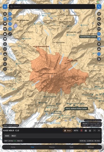
Start with a map, then move into the detail: dynamic procedures, airport layouts, runway and weather context, NOTAMs, handlers, and the information that makes a route usable.
Browse FAA-derived procedures, select transitions and approach paths, and inspect minima and vertical context.
Browse proceduresFind airports by geography and operational filters, then inspect layouts, runways, weather, FBOs, customs, and nearby context.
Open airportsKeep conditions, radar, winds, and terrain in the same planning surface instead of turning the brief into tab management.
View weatherThe planning tools cover the gaps between a route request and a plan you can actually brief.
Build one-way and multi-stop trips with aircraft profiles, fuel math, runway limits, timing, and route options.
Open plannerLook up filed route history and compare winds aloft, ground speed, headwind, and segment conditions.
Lookup routesPlan the whole movement around the flight: ground time, stops, customs, fuel, and arrival windows.
Open assistantUse the focused utilities when the question is specific, then carry the answer back into the trip.
Find AOE and CBP airports, hours, fees, FBOs, and weekend availability along the route.
Find customsFilter airport context by FBO and fuel-program details while comparing stops and alternates.
Find airportsReview recent observations with parsed wind, visibility, ceiling, temperature, and altimeter context.
View METAR historyReady to use it? Launch directly into the Aeronautic map and start with the airport, route, or procedure in front of you.